Koiteli’s quartzite-conglomerate formation is Proterozoic rock and dates to over 2090 million years. In Koiteli, the formation is pierced by slightly younger gabbros (over 1870 million years). There are traces of shifting in the bedrock, even in the rapids of Koiteli you can see shift zones.
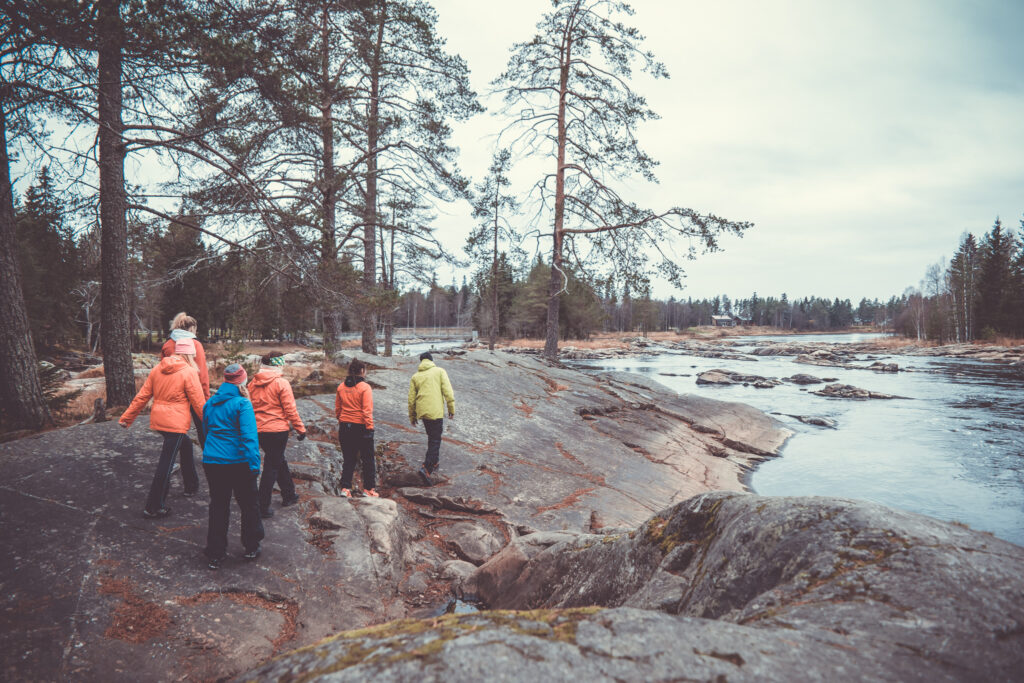
During the last ice ages, some 30,000–10,000 years ago, the rock surface was smoothed by the impact of rock material under the huge kilometer-thick mass of ice even though quartzite is a strong and durable stone. This is how the roche moutonnée (or sheepbacks) that we can admire now were born.
The furrows, from which the direction of movement of the glacier can be seen, were created by stones on the ice floor. These stones scratched the rock as the ice moved slowly but surely forwards or backwards, depending on whether there was a warm or cold season during the ice age. Based on the furrows on the Koiteli rock, the movement directions of two different glaciers can be seen: an older one running in a west-east direction and a younger one in a northwest-southeast direction. You can study the directions of the grooves yourself with the help of a compass.
The flora in Koiteli is quite diverse. There is scarce but decorative moss, sedge and shrubs of the rock crevices and young pine and spruce forests as well as most lush groves and sunny meadows. Red shore flowers and white flowered water crow-foots bloom by the rapids.
There are also rare species among the more than two hundred plants in the area, such as common moonworts and leather grapewerns in Sahasaari. Common moonworths hide in low-grass fields, sometimes invisible for years but when the summer is humid and warm, they emerge in hundreds. However, their shoots are very small and pale green, so they go unnoticed by many. These plants are rare in Finland and therefore need to be looked after.
The soil in Koiteli is mostly moraine, but also gravel, sand and silt are found on the shores. These are mostly formations built by the flowing waters of Kiiminkijoki river.
The name Koiteli is with reasonable certainty of Sámi origin and means ‘the one in the middle’. The course of history has left the area with traces of industry, travel, trade, and the ultimate human need of gathering. Koiteli has always been a significant center of the Kiiminkijoki river. The area has been more than a nature destination and is characterized by the long-standing interaction between man and nature.
Around 5,000 years ago, the Bay of Bothnia reached Koiteli. The coastline was winding and there were several small islands and islets, that were perfect places for fish to spawn. There were also plenty of seals in the area. As the seals were an important source of nutrition, it is no wonder the first signs of people in Kiiminki have been found on the shores of Koiteli.
Foundations of dwellings, but also stone objects related to everyday life have been found in the area: a cross-bladed ax and a large ice pick. As land upheaval slowly happened and the seashore moved away, Kiiminki area was left slightly remote, the shores of Iijoki and Oulujoki rivers became good places to dwell. It took a long time before man habited the areas near Koiteli permanently, probably only in the 16th century. The riverside remained unbuilt and was used for leisure. The islands were used as pastures. One of the islands of Kiiminkijoki river was used for potato farming and a couple of others as temporary burial places in the summertime as the journey to the nearest churchyard was challenging.
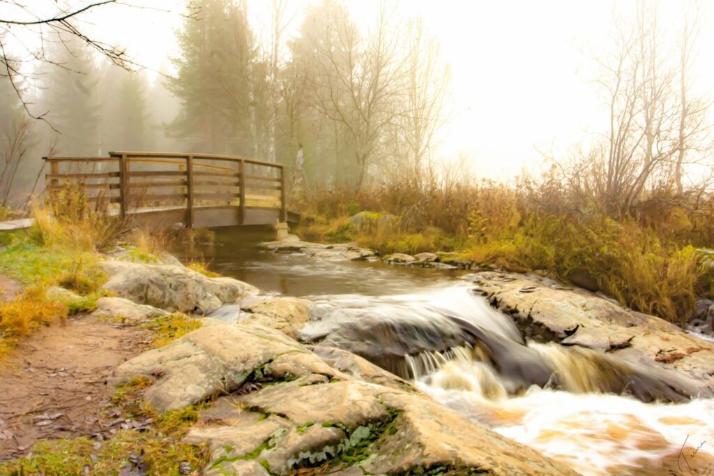
Koiteli rapids were harnessed for the use of sawmills for almost all of the 19th century. As the sawing came to an end, there were plans for a power plant. Koiteli has always had recreational value for the locals and since the 1950’s, recreational use has been developed by e.g. building bridges connecting the islands.

View larger map
Kiiminkijoki kuoriutuu jääpeitteestään huhtikuun loppupuolella ja se on merkki Koitelin koskenlaskukauden avaukselle. Kuohuva Koiteli on erityisesti yritysryhmille suunnattu koskenlaskuelämys. Ohjelma sisältää kaksi laskua Koitelin upealla koskialueella.
Ohjelman aluksi otamme tuntumaa veteen selättämällä Tulikurkku-nimisen könkään ja suuntaamme kohti ”Uittoränniä”. Toinen laskuista tapahtuukin sitä reittiä, mitä uskallamme yrittää. Ammattitaitoiset kipparimme luovivat ryhmänne läpi kimuranttien kuohujen. Ohjelman aikana nautitaan kahvit ja maittavat retkieväät omalla tulipaikallamme Uittokämpän pihamaalla tai Koitelin Tunnelmatuvan suojissa.
Jokaisesta myydystä Uittorännin koskenlaskusta ohjaamme 0,5 €/hlö Suomen Luonnonsuojeluliiton Vapauta virrat -kampanjalle. Katso yrityksemme vastuullisuuslupaus.
Ohjelma sisältää: Yllä mainitun ohjelman, kahvit, makkaraa, virvokkeita ja pikkuleipiä sekä oppaiden palvelut.
Varusteet: Kypärä, pelastusliivi, sadepuku ja kumisaappaat. Varaa mukaan vaihtovaatetta!
Osallistuminen alkoholin vaikutuksen alaisena ehdottomasti kielletty!
Tapaamispaikka: Koitelin Koskikippari, Ylikyläntie 184, Kiiminki. Koitelin Koskikippari
Lisämaksusta: Kuljetukset (Oulu–Koiteli–Oulu), saunatilat, ruokailut
Koko päivä Koitelissa? Tutustu Uittokämpän kokouspakettiin tästä:
Ohjelman kesto: n. 2½ tuntia
Toteutusaika: 1.5.–6.6. (vesitilanteen mukaan)
Hinta: Yli 15 hlöä 64 € / hlö, alle 15 hlöä 69 € / hlö
sis. alv. 10 %
Hinta sisältää kuljetukset pukutilan ja lähtöpaikan välillä.
Minimilaskutus: 8 hlöä
Vakuutus: Go Arctic Oy:llä on oman toimintansa kattava järjestäjän vastuuvakuutus
Koitelin koskialue soveltuu erinomaisesti kevyillä välineillä tapahtuvaan viehe- ja perhokalastukseen. Luontaisina saaliskaloina alueella ovat harjus, ahven ja hauki. Lisäksi pyyntikaudella jokeen istutetaan pyyntikokoista taimenta.
Ohjelma sisältää perhokalastuksen opetusta ja tunnelmallisen kala-aterian nuotion loimussa. Onpa asiakkailla mahdollisuus kokeilla myös oman perhon sitomista. Pääasiana on kuitenkin tietysti kalastus ja luonnosta nauttiminen. Asiantuntevat oppaamme antavat vinkkejä kalastustekniikan lisäksi parhaista ottipaikoista ja vieheiden väreistä.
Hinta sisältää: Perhokalastuksen ja perhonsitomisen opetusta, evästelyt tulilla (makkaranpaistoa, virvokkeita, kahvia ja pikkuleipiä) sekä kalastukseen tarvittavat luvat.
Lisämaksusta: Kuljetukset. Sadetakki, kumisaappaat ja sukat.
Ohjelman kesto: n. 5 tuntia
Toteutusaika: Kesä-syys
Hinta: 75,00 € / hlö sis. alv. 10% (minimilaskutus: 5 hlöä)
Vakuutus: Go Arctic Oy:llä on oman toimintansa kattava järjestäjän vastuuvakuutus.
Raikas ulkoilma, Koitelin koskien villit ja vapaat kuohut sekä unohtumattomat maisemat luovat mainiot puitteet virkistyspäivän viettämiselle. Kun mukaan heitetään vielä aivotyöskentelyä vaativia logiikkatehtäviä, niin mikäs siinä on tyhy-päivää vietellä! Koitelin hyväkuntoisten reittien varrelle olemme järjestäneet ryhmällenne erilaisia rasteja, joihin tarvitsette yhteistyötä, luovuutta ja toinen toisensa auttamista. Tiimityötaidot vahvistuvat kuin itsestään. Rastien jälkeen maistuu makkara ja kahvi.
Hinta sisältää:5 erilaista tehtäväpistettä Koitelin koskialueella, kahvia ja keksiä, grillimakkara, oppaiden palvelut ja tarvittaessa sadetakki.
Ohjelman kesto: n. 2 h
Toteutusaika: Touko-marras
Hinta: 42,00 €/ hlö sis. alv. 10% (minimilaskutus 10 hlöä)
Vakuutus: Go Arctic Oy:llä on oman toimintansa kattava vastuuvakuutus.
Varustus: Asiakkaan oma ulkovaatetus